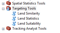
Targeting toolbox is an ArcGIS toolbox (.pyt) purely developed using Python programming language. The toolbox has three tools that were developed with an aim of identifying land that is suitable for a certain crop to grow based on user criteria. The three tools are:
-
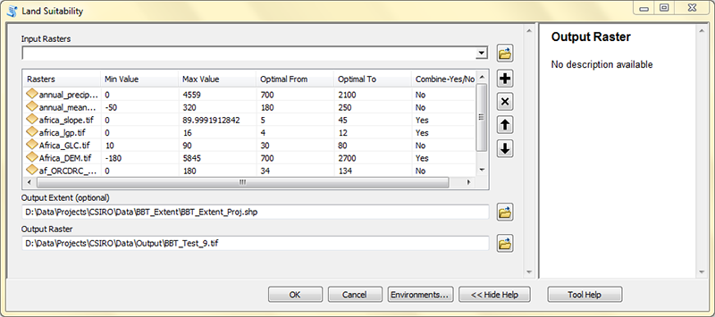
Land Suitability: This tool can be used to identify areas that ,are suitable for planting a certain type of crop as per the user criteria. Please click on the Help Tool button once you install the toolbox in ArcGIS environment to get information on how to use it.
-
Land Similarity: A tool that can be used to find suitable sites that are similar to already existing farmlands under a certain type of crop.
-
Land Statistics: Use this tool to perform spatial statistics on the Land Suitability tool output. It takes in more than one input value raster and a vector boundary that would limit your analysis.
-
The tools work with ArcGIS version 10.1 and above.
-
At a minimum, the tools require the Spatial Analyst Extension to run.
-
Download the Targeting Tools 0.5.4 toolbox
-
Move the zip file to the directory where you want to store the toolbox.
-
Extract the contents of the zip file.
-
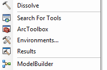
Open ArcMap 10.1 or any version above it, and click Geoprocessing > ArcToolbox.
-
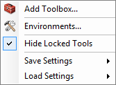
Right-click the ArcToolbox window, and click Add Toolbox.
-
In the Add Toolbox window, click the Connect to Folder icon and navigate to the location of the toolbox. Select the Targeting Tools.pyt file and click Open. The Targeting toolbox appears in the ArcToolbox window.
-
Start using the Targeting toolbox!
© 2015 Commonwealth Scientific and Industrial Research Organisation - CSIRO | International Center for Tropical Agriculture - CIAT. All rights reserved.


